
Home > Browse by Institution > NOAA > Ningaloo sea surface temperatures (SST)
Ningaloo sea surface temperatures (SST)
- Commonwealth Scientific and Industrial Research Organisation,
- National Oceanic and Atmospheric Administration
- Commonwealth Scientific and Industrial Research Organisation,
- National Oceanic and Atmospheric Administration
Sea surface temperature (SST) is the water temperature close to the ocean’s surface. SST’s are generally measured using weather satellites, and are central to interactions of the ocean and the atmosphere that control climate and weather. As such, tropical storm and cyclone formation are strongly influenced by SST, ocean nutrient concentrations and primary production are correlated with SST, and coral bleaching events are usually caused by long periods (usually 4 to 8 weeks) of warmer than average summer SST’s.
While in situ sea temperature measurements have a number of advantages (e.g. site specificity, temperature change with depth, continual temperature measurements etc.), the costs of purchase, deployment and retrieval, coupled with logger malfunctions, often render in situ measurement data difficult to access. SST’s on the other hand, while only giving data on the surface temperatures, are available daily, and therefore provide useful spatial and temporal temperature data sets.
Three SST data sets are available for Ningaloo (see Excel spreadsheet below).
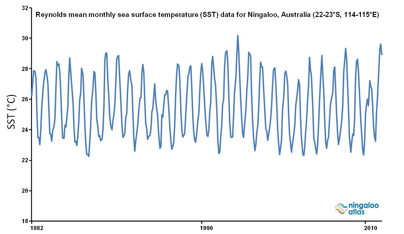
Reynolds SST (22-23°S, 114-115°E) |
click image for larger image view |
|
Spatial resolution: 100 km Coordinates: 22-23°S, 114-115°E Measurement frequency: Monthly averages Measurement units: Sea surface temperature (SST, °C) Time series: January 1982 to March 2011 Custodian and methodology: Alan Pearce and Ken Suber |
 |
NOAA Coral Reef Watch SST (21.5°S, 114°E) |
click image for larger image view |
|
Spatial resolution: 50 km Coordinates: 21.5°S, 114°E Measurement frequency: Twice weekly Measurement units: Sea surface temperature (SST, °C), Sea surface temperature anomaly (SSTA, °C), Degree Heating Weeks (DHW, °C-weeks) Time series: January 2001 to May 2012 Custodian and methodology: NOAA Coral Reef Watch |
 |
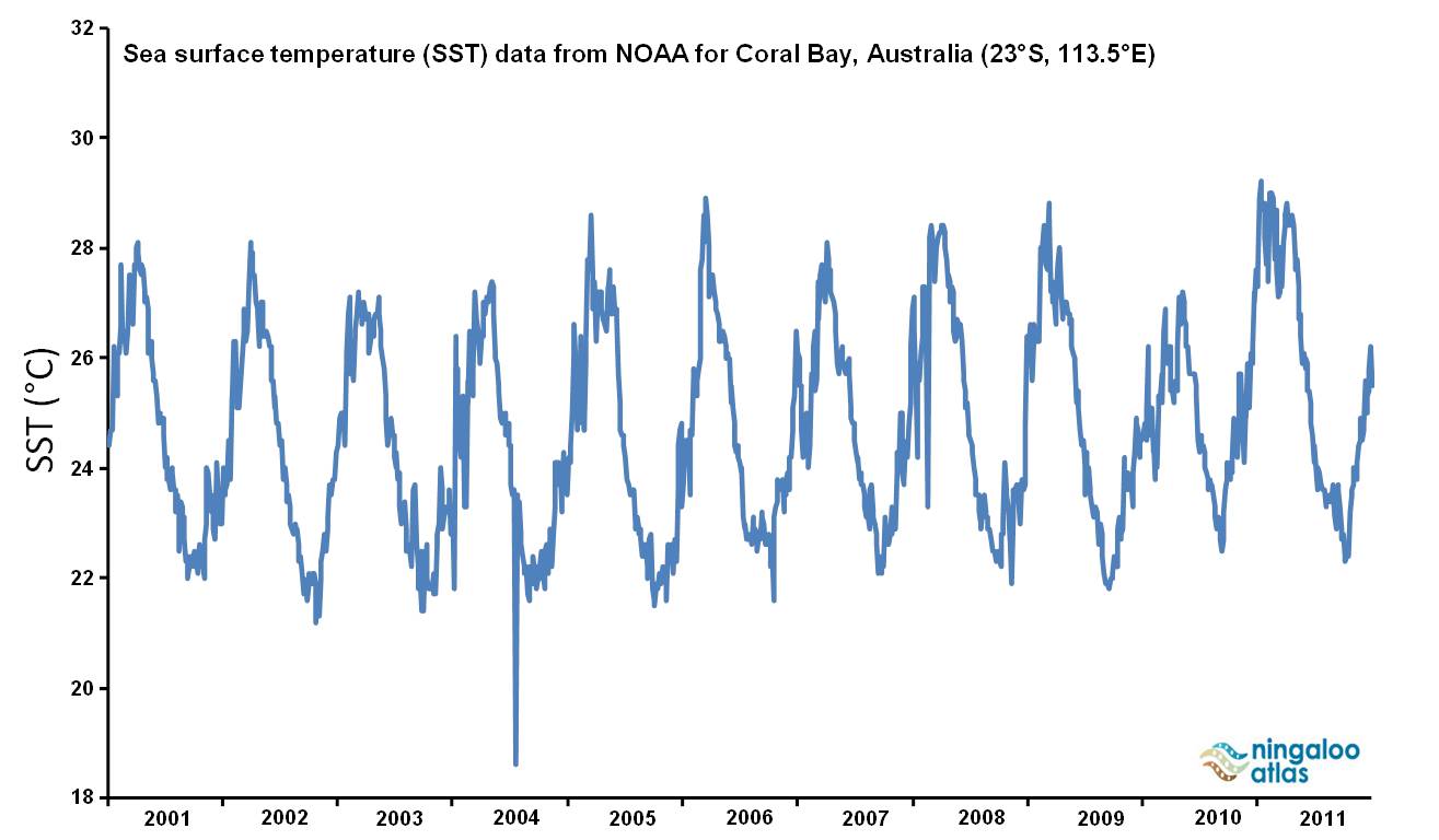
NOAA Coral Reef Watch SST (23°S, 113.5°E) |
click image for larger image view |
|
Spatial resolution: 50 km Coordinates: 23°S, 113.5°E Measurement frequency: Twice weekly Measurement units: Sea surface temperature (SST, °C), Sea surface temperature anomaly (SSTA, °C), Degree Heating Weeks (DHW, °C-weeks) Time series: January 2001 to May 2012 Custodian and methodology: NOAA Coral Reef Watch |
 |
Dataset details
| Owner institutions | Commonwealth Scientific and Industrial Research Organisation (http://www.csiro.au) National Oceanic and Atmospheric Administration (http://www.noaa.gov/) |
| Spatial extent | Ningaloo (22-23° S, 113-115° E) |
| Data collection | January 1982 to May 2012 |
| Copyright | Copyright remains with the data owner(s) |


